Our Services
Geospatial Services
Geographic Information Systems (GIS)
A geographic information system (GIS) lets us visualize, question, analyze, and interpret data to understand relationships, patterns, and trends.Engineering Support Activities
The key issues for engineering support are to coordinate the participants and to provide each engineer an environment.Digital Photogrammetry
Well-established technique for acquiring dense 3D geometric information for real-world.Computer Aided Designing and Drafting (CADD)
View a design from any angle with the push of a button and to zoom in or out for close-ups and long-distance views.Digital Image Processing
Digital image processing, as a computer-based technology, carries out automatic processing, manipulation and interpretation of such visual information.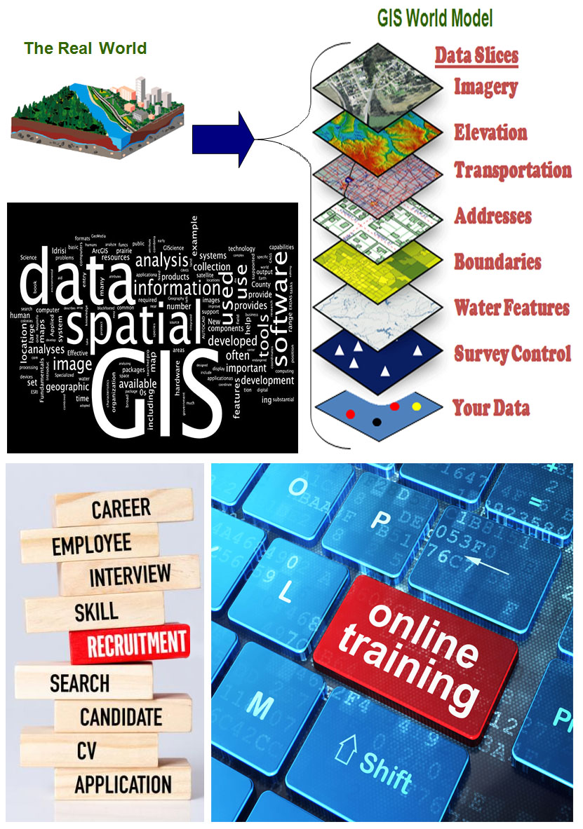
Geospatial Services Contd...
Land Surveys Using Modern Techniques
Surveyors and companies performing surveying services now use this new, modern, accurate and effective equipment.Natural Resources Management and Mapping using Remote Sensing
Geospatial information are quite useful in the identification and analysis of factors that affect the utilization of these resources.Database Development
We use a normalized conceptual database design in the conversion to a logical relational database design.Online Training

HR Services

Our FEATURES

24/7 Support
DataGroup is proud to offer 24/7 technical Support for our customers. Our dedicated team of service technicians is here to help and provide assistance around the clock.

Personal Approach
We approach our clients and We believe that the best way to interact with others is by putting ourselves in their shoes and seeing things from their perspective.

Quality
We strive to delight our customers each time and build long term relationships by delivering high quality work with speed and excellence.

Cost
We deliver our services at a very low and effective cost compared to our competitors.

Team Support
We are passionate about our work. We have a strong believe in our self, which enables us to perform our responsibilities at maximum.

Off Shore
Our team of young & passionate individuals working to achieve our company vision. Our Offshore development model has a unique distinction of effective cost and quality advantage.

Execution
With a wide range of project execution and costing models, We are very client-centric, cost-effective and process driven quality.

Managment
Our winning strength lies in our key people and our success on our ability to attract, develop and motivate the best.
Our Works
-
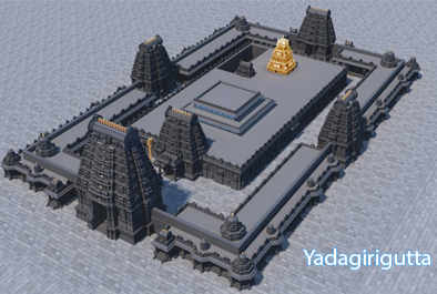
Yadagirigutta
Prepared GIS based Base Map showing details of existing features including other associated features and attributes for Yadagirigutta Temple Development Authority. Read More...
-
TMDP
World Bank Assisted Project as a Associate Consultant under Telangana Municipal Development Project (TMDP) - Preparation of GIS Base map for 8 ULB's in Telangana state covering, Establishing Survey Control Points for Georeferencing and Ortho rectification of Satellite Images, Feature Extraction and Attribute updation, Establishment of Permanent Bench Markers, Generation and Overlay of 1m interval Contours, Incorporation of Cadastral Information, Field Verification Survey, & Check Plots, QC, Final Base Map Prepration (On-Going).
-
Our Clients
-

Vemulavada
Prepared GIS based Base Map showing details of existing features including other associated features and attributes for Yadagirigutta Temple Development Authority. Read More...
-
APMDP
World Bank Assisted Project as a Associate Consultant under Andhra Pradesh Municipal Development Project (APMDP) - Preparation of GIS Base maps for 4 ULB's, Carrying out revenue Improment Service, Implementation of new house numbering system. (On-Going).
Read More... -
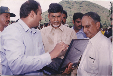
MD with Hon'ble AP CM
DataGroup MD Explaining about Asset Mapping, Asset Geo-Tagging Techniques in Watershed Management
200+
Completed Projects
100+
Our Clients
Current States
5000+
Training Hours
200+
Placements